If your university already gives you ArcGIS, use it. Otherwise start with QGIS: it is free forever, runs natively on macOS, Linux and Windows, and can do every core task a thesis chapter needs. ArcGIS Pro earns its place when you specifically need its 3D, geostatistical or network tooling, or when your department’s whole lab runs on it.
That two-sentence rule is what most student researchers land on after a few weeks of using one and reading about the other. The reason it holds is not that either program is weak. Both are mature, professional GIS software. The reason is that ArcGIS access is licensed, institutional and time-limited, while QGIS access is permanent and personal.
The rest of this comparison looks at the decision properly: what each platform really is, what it costs to get hold of, how steep each learning curve is, how well each handles spatial analysis and awkward data formats, how publication-ready the maps are, and which one to pick for the kind of project you are actually doing. I have kept the focus on student research throughout, because the general question of which GIS is better has a different answer than the question most people arrive with.
Table of Contents
- 1QGIS vs ArcGIS for Student Research Projects at a Glance
- 2What Is QGIS and When Does It Suit Student Research?
- 3What Is ArcGIS and When Does It Suit Student Research?
- 4QGIS vs ArcGIS: Cost, Licensing, and Student Access
- 5How to check whether your university provides an ArcGIS site licence
- 6What ArcGIS actually costs a student, and how to reach it cheaply
- 7What happens to your ArcGIS licence after graduation
- 8QGIS vs ArcGIS: Learning Curve and Academic Workflow
- 9QGIS vs ArcGIS: Spatial Analysis and Data Compatibility
- 10QGIS vs ArcGIS: Maps, Visualization, and Presentation
- 11QGIS vs ArcGIS for Common Student Research Projects
- 12Questionnaire and field survey research
- 13QGIS or ArcGIS for environmental and remote sensing projects
- 14Urban planning and transport projects
- 15Public health and spatial epidemiology
- 16Undergraduate and postgraduate capstone work
- 17Field data collection on your phone or tablet
- 18Which Should You Choose?
- 19Frequently Asked Questions
- 20Is ArcGIS better than QGIS?
- 21Is QGIS still free?
- 22How much does ArcGIS cost for students?
- 23Which GIS software is best for a thesis or dissertation?
- 24Is ArcGIS Desktop retired, and what should I be using?
- 25Can I use ArcGIS after I graduate?
- 26What to Do First
QGIS vs ArcGIS for Student Research Projects at a Glance
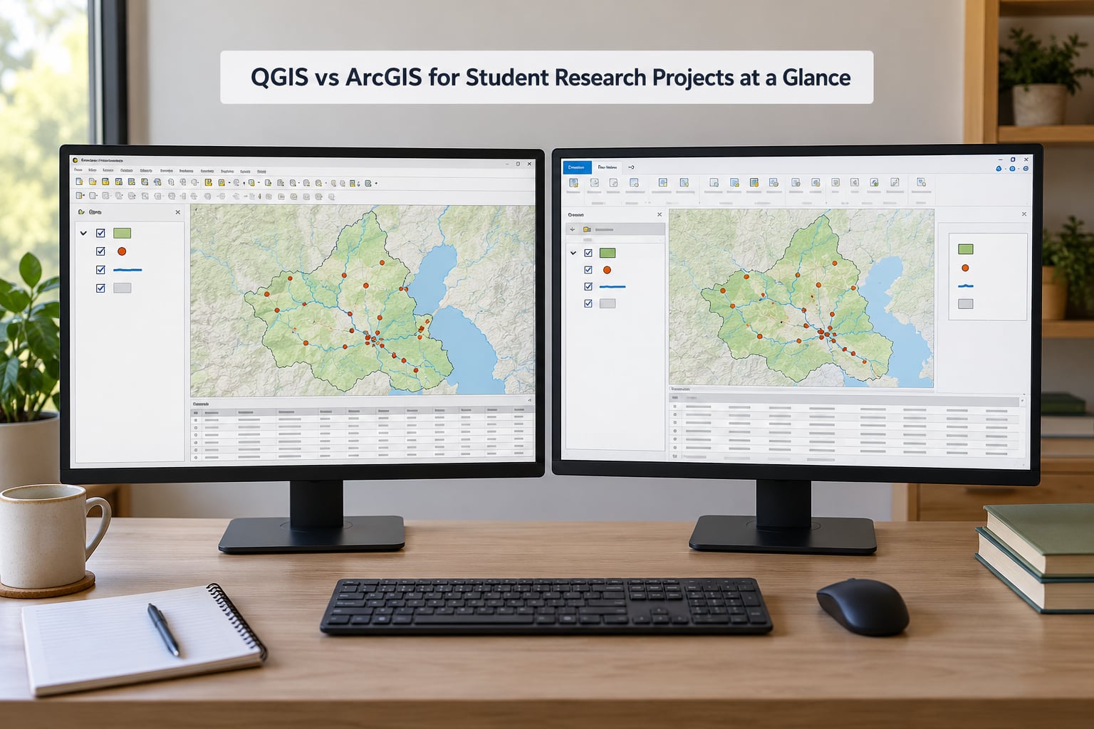
The table below is the whole comparison in one place. Every row is something a student has to decide about at some point during a project, usually under a deadline.
| Decision factor | QGIS | ArcGIS Pro |
|---|---|---|
| Cost to a student | Free, no licence fee ever | Commercial subscription, usually covered by a university site licence |
| Licence model | GNU General Public License, open source | Named user or single use licence tied to Esri accounts |
| Windows, macOS, Linux | Native on all three | Windows native, macOS through virtualization |
| Current desktop product | QGIS 3.x long term release | ArcGIS Pro, with ArcMap and ArcGIS Desktop retired |
| Core vector and raster analysis | Processing toolbox, fully capable | Geoprocessing tools, fully capable |
| Spatial statistics | Built in plus plugins such as WhiteboxTools | Geostatistical Analyst extension, very polished |
| Network and routing analysis | Shortest path and network tools in core | Network Analyst extension, richer network datasets |
| 3D and terrain visualization | Improving, still behind for city and terrain models | 3D Analyst and ArcGIS Online scenes, clearly ahead |
| Visual workflow modelling | Graphical Modeler, functional but crash prone | ModelBuilder, widely regarded as the more intuitive of the two |
| Scripting | PyQGIS, Python 3, fully supported | ArcPy, Python, fully supported |
| Open data format reading | Very broad through GDAL and OGR | Broad, with file geodatabase as the native format |
| Cartographic polish | Excellent when you learn the layout engine | Excellent out of the box, especially for print |
| Field data collection | QField, free, works offline | Field Maps and Survey123, tied to ArcGIS Online |
| Help resources | Official documentation plus GIS Stack Exchange | Structured Esri documentation, training, and the same forum |
| Access after graduation | Yours forever on any machine | Institutional access normally ends at graduation |
| Job market signal | Strong in open data, ecology, NGOs, Global South work | Recognised by government, utilities and enterprise GIS teams |
Read the last two rows together, because they are the ones that decide most cases. If you plan to keep working in GIS after you finish, QGIS follows you out of the building with no paperwork. ArcGIS, unless you buy your own licence, does not.
One more piece of context. Both tools are mature enough that user communities rate them in the same tier, so this is not a case of one program being excellent and the other being a toy. The difference in student outcomes comes from access and support, not from raw quality.
What Is QGIS and When Does It Suit Student Research?
QGIS is a geographic information system, meaning software for working with data that has a location attached to it. It is free, open source and released under the GNU General Public License, which means anyone can use, modify and redistribute it without paying a licence fee. It is developed by an open foundation rather than a single company, with OSGeo as the home of the project.
The interface is the closest thing to a familiar desktop GIS: a layers panel, a map canvas, and a browser. That layout will feel obvious to you if you have used any mapping tool, and it is worth ten minutes of play before you commit to either platform for a project.
Underneath, QGIS is less obvious and more capable than first impressions suggest. It reads a very wide range of vector and raster formats through the GDAL and OGR libraries, which are the same libraries many other tools use under the hood. That is why a shapefile, a GeoJSON file, a GeoPackage, a PostGIS database table and a GeoTIFF raster all open without friction.
The Processing toolbox is the heart of it. Buffers, overlays, raster calculators, interpolation, reprojection, topology checks and hundreds of other operations sit in one searchable panel, and most of them run identically on Windows, macOS and Linux. That is a genuine advantage over ArcGIS Pro, which students on a Mac laptop feel immediately.
Where QGIS gets its specialist capability is the plugin repository. Plugins cover hydrology, remote sensing, ecology, demographics, LiDAR processing and much more. The trade is consistent: extraordinary breadth, with the occasional plugin that breaks after a release.
So which student projects suit it? Mapping and thesis visualisation, field survey data handling, basic spatial statistics, land cover change analysis, and any project where the software must keep working after your laptop is reformatted. It is also the natural fit for reproducibility work, because PyQGIS scripting is transparent, version-controlled and free of licence expiry.
What Is ArcGIS and When Does It Suit Student Research?
ArcGIS is Esri’s commercial GIS suite, and Esri is the dominant commercial GIS vendor, headquartered in Redlands, California. ArcGIS Pro is the current desktop application. That last point matters more than it sounds, because a large share of tutorials and course material you will find online was built on ArcGIS 10.x and ArcMap, which are legacy products.
Check the version number in any tutorial before you follow it. If it teaches you to open ArcMap or ArcCatalog, you are reading material for a product generation that has been superseded, and the menus will not match what you see in front of you. That gap is the single most common reason students conclude that ArcGIS is confusing when they have actually just found an out-of-date guide.
ArcGIS Pro itself is a 64-bit desktop application with a ribbon interface, a unified 2D and 3D view, and deep integration with ArcGIS Online. That online side is the part students underestimate. It hosts web maps, story maps, dashboards, field data collection apps and hosted services, and a departmental account may give you access to all of it without any extra setup.
Analytically, ArcGIS Pro is very strong where QGIS needs a plugin or a workaround. Network analysis with full network datasets, geostatistical analysis with a polished guided workflow, 3D city and terrain modelling, and image classification for remote sensing are all more finished out of the box. Some of this lives in extensions such as Spatial Analyst, 3D Analyst, Network Analyst and Geostatistical Analyst, which are licensed separately and often bundled by universities.
So which student projects suit it? Anything with heavy raster and imagery analysis, complex network or travel-time modelling, 3D visualisation for architecture and planning work, geostatistical interpolation for environmental or health sampling, and any project where you must hand work to a supervisor, collaborator or journal workflow built around Esri formats.
QGIS vs ArcGIS: Cost, Licensing, and Student Access
This is the section most students actually needed. Cost, not capability, decides the software question for most student researchers, and an unfunded doctoral researcher who cannot pay a subscription but still needs publication-grade output is the classic case.
QGIS costs nothing to download, install, run and update. There is no licence fee, no subscription, no expiry date and no paid edition being introduced. You can install it on a personal laptop, a departmental machine or a cluster, and it will still be there in five years.
ArcGIS is sold as a subscription, and the price depends on the modules, the user type and your region, which is exactly why nobody sensible quotes a single figure. What matters for you is not the number but the route to access. There are several, and they are worth checking in order.
How to check whether your university provides an ArcGIS site licence
- Ask your department’s GIS or research support officer, or your supervisor, directly whether ArcGIS Pro is covered by an institutional licence.
- Search your university’s IT services and software catalogue pages for ArcGIS. University-wide licences are usually listed publicly, sometimes behind a login.
- Check whether the licence is a named user licence, which means you sign in with your university account, or a single use licence installed on specific lab machines.
- Look at what is included. Some institutional licences cover ArcGIS Pro alone, while others bundle the Spatial Analyst, 3D Analyst, Network Analyst and Geostatistical Analyst extensions, or include ArcGIS Online credits.
- Note the access rules. Ask about expiry, whether you may use it from a personal laptop, and whether access continues after you graduate.
Not all institutions participate in the Esri education programme, so do not assume. It is also common for a geography or planning department to have ArcGIS while a neighbouring department does not, which makes asking the person two doors down surprisingly useful.
What ArcGIS actually costs a student, and how to reach it cheaply
| Route | What you get | Who qualifies and how to apply |
|---|---|---|
| University site licence | ArcGIS Pro, sometimes with extensions and ArcGIS Online credits | Enrolled students and staff; check with your department or IT service |
| ArcGIS for Student Use | A named user licence with a term of a few years, plus online services | Individual students through the Esri education programme |
| Esri scholarship and student competitions | Licence plus training and mentorship for the award period | Apply through Esri with academic references |
| Trial or training access | Short term product access for evaluation and courses | Available from Esri, usually time limited |
| QGIS, always | The full desktop application at no cost, indefinitely | Anyone, on Windows, macOS or Linux |
Three details about student ArcGIS licences catch people out. First, a student licence is usually a multi-year term rather than something you renew weekly, which makes it perfectly comfortable for a thesis, but it does have an end date. Second, at the end of the term you either convert to personal-use terms or move to a regular subscription. Third, a student licence sits in your own Esri account and your own organisation, so it is not the same thing as your university site licence and the two do not merge.
What happens to your ArcGIS licence after graduation
This is the licensing cliff, and it deserves more attention than it gets. Institutional access normally ends at graduation. After that, the tool your entire visual vocabulary is built in simply stops opening, and you cannot practise on your own data without paying out of pocket.
Some graduates take the practical route: keep QGIS installed for personal and freelance work, and treat ArcGIS as an institutional tool you use during the years you have access to it. That is a perfectly defensible arrangement, and it is why a lot of working GIS professionals know both.
QGIS vs ArcGIS: Learning Curve and Academic Workflow
Both programs have a reputation for jargon, and both deserve it slightly less than they get. Beginners report being overwhelmed by acronyms rather than by the software, so it is worth clearing those up early. GIS means geographic information system. CRS means coordinate reference system, the rule set that says what the numbers in your coordinates mean. A datum is the reference model the coordinates sit on. Geoprocessing means running an operation on spatial data. PyQGIS and ArcPy are the Python scripting environments for each platform. A geodatabase is Esri’s container format for spatial data. OGC refers to the open standards bodies that define shared data formats.
With those defined, the difference in learning curve is smaller than the forums suggest. ArcGIS Pro has more built-in structure: a single Add Data control, a consistent ribbon, and documentation that reads like a manual. QGIS has a flatter interface with more separate buttons for loading different data types, and its official documentation assumes more GIS vocabulary.
There is a training asymmetry worth knowing. Most free introductory GIS courses are built on ArcGIS, so if you choose QGIS you will be self-directing more of your learning through the QGIS documentation and GIS Stack Exchange, which is where most of the useful QGIS answers actually live. That is not a reason to avoid QGIS. It is a reason to plan for it.
Where the platforms separate for academic work is visual workflow modelling and reproducibility. ArcGIS ModelBuilder chains geoprocessing steps in a diagram that most people find easier to read than QGIS Graphical Modeler, which is functional but reported to be crash prone. For a methods chapter, though, both are weak evidence on their own, because a click path cannot be audited by a reader.
A seven-point reproducibility checklist for a thesis or dissertation is worth keeping in a project folder:
- Script your analysis steps rather than clicking through them, so a reader can re-run them.
- Commit project files and scripts to a version control repository, so each chapter’s state is recoverable.
- Record the coordinate reference system of every dataset, and the reprojection you applied.
- Save the processing history for any tool you ran manually.
- Fix and record random seeds for any stochastic step, such as sampling or a random forest classification.
- Archive source data with a retrieval date or DOI, so the inputs can be obtained again.
- Record software versions, including the QGIS release or ArcGIS Pro release, in your methods chapter.
PyQGIS is widely praised for exactly this kind of transparency, partly because it is plain Python that any reader can follow without owning a licence.
QGIS vs ArcGIS: Spatial Analysis and Data Compatibility
For most thesis chapters, both programs clear the bar. Buffers, overlays, dissolve, clip, spatial joins, raster algebra, terrain derivatives, interpolation and network analysis all exist on both sides. The differences show up in the specialist corners and in how forgiving the tools are about messy real-world data.
| Student task | Better in QGIS | Better in ArcGIS Pro |
|---|---|---|
| Buffer, clip, overlay, spatial join | Core Processing toolbox | Core geoprocessing tools |
| Catchment delineation and hydrology | SAGA, GRASS GIS, WhiteboxTools plugins | Hydrology tools in Spatial Analyst |
| Interpolation and kriging | Core tools plus plugins | Geostatistical Analyst, guided workflow |
| NDVI, band maths, classification | Raster calculator and raster analysis plugins | Image Analyst and Spatial Analyst |
| Routing, travel time, network datasets | Core network analysis, simpler setup | Network Analyst, richer network models |
| 3D city or terrain model | Third-party 3D plugins, catching up | 3D Analyst and online scenes |
| Spatial database queries | SpatiaLite and PostGIS support in core | File geodatabase and enterprise geodatabases |
| Vector and raster format coverage | Very broad through GDAL and OGR | Broad, strongest on its own formats |
On data formats specifically, QGIS is the more forgiving of the things students actually receive. Public survey exports, open government boundaries, Landsat or Sentinel scenes, university field data in an Excel export and downloaded tiles in half a dozen container formats will all open in QGIS without a conversion step. ArcGIS reads them too, but you will meet it asking for a file geodatabase or a feature class more often.
Two cautions apply to both, and they cause more lost marks than any software choice. First, get your coordinate reference systems right. Reprojecting on read and then measuring distance produces numbers that are wrong in ways nobody can see in the output. Decide one projection for your analysis early, record it, and reproject explicitly rather than trusting the on-the-fly setting.
Second, note that a geostatistical result is only as good as your sample design. No platform fixes a biased sampling frame. If your interpolation looks implausibly smooth, the problem is upstream of the software.
QGIS vs ArcGIS: Maps, Visualization, and Presentation
Both platforms can produce journal-quality figures. The honest version of the claim is that QGIS output is achievable with the right cartographic workflow, not automatic.
QGIS Print Layout gives you a full page composition tool: map frames, legends, scale bars, north arrows, grids and a full set of map variables, with export straight to PDF, SVG, PNG or TIFF at whatever resolution your journal asks for. Its Atlas feature generates a series of maps from a layer of features, which is the tool for a per-region figure set in a thesis appendix. Labeling is powerful once you understand rule-based labelling, and it is fiddly until you do.
ArcGIS layouts are a step more polished out of the box, particularly for print cartography and for the label placement engine. Data-driven pages does the same job as Atlas, and Esri’s symbology options give a slightly more finished impression with less fiddling. If your supervisor or your target journal expects Esri output, this is where the difference shows.
For publication, check your journal’s figure requirements early rather than at submission. Common demands include a minimum effective resolution of 300 dots per inch for continuous tone images, vector formats such as EPS or PDF for line work, CMYK colour for print journals, specific font embedding rules and file naming conventions. Both platforms can meet all of these. The difference is that QGIS exports are fully under your control with no licence-based limits on output formats.
Interactive output is where ArcGIS has a clear lead, because ArcGIS Online, Story Maps, Experience Builder and dashboards are all part of the same subscription and often already available through your university. QGIS has QGIS Server, plugins for web mapping and open standards support, so it is not a dead end, but it is more of a build-it-yourself path.
QGIS vs ArcGIS for Common Student Research Projects
Questionnaire and field survey research
If your data arrives as a spreadsheet with coordinates or addresses, both programs handle the join. QGIS is usually the smoother path because the geocoding plugin options are plentiful and free, and because SpatiaLite or a GeoPackage handles survey joins without licensing concerns. ArcGIS is smoother if your department already uses ArcGIS Online geocoding services, but watch the credits system, which is easy to misjudge and can generate unexpected cost at scale.
QGIS or ArcGIS for environmental and remote sensing projects
This is the one field where the answer genuinely depends on the method. Land cover change, vegetation indices and supervised classification all work well in QGIS with the right plugins, and WhiteboxTools covers a remarkable amount of terrain and hydrological analysis for free. ArcGIS Pro wins when your method requires image classification across large mosaics, guided geostatistical surfaces, or a 3D terrain model that has to look convincing in a defence presentation. Whichever you choose, write your processing steps down as you go.
Urban planning and transport projects
For suitability analysis, land use mapping and catchment modelling, QGIS is entirely adequate and free. For network analysis with realistic travel-time surfaces, junction modelling and multi-modal routing, Network Analyst is more capable. For 3D city visualisation, ArcGIS has a genuine lead that QGIS plugins have not fully closed.
Public health and spatial epidemiology
Here the deciding factor is usually data access rather than software. Health datasets arrive as shapefiles, GeoJSON or tables with latitude and longitude fields, all of which both programs read. QGIS tends to win for students doing exploratory work with census and deprivation data because of the plugin and processing breadth for joining and reweighting, and because you can keep the whole pipeline in one free environment.
Undergraduate and postgraduate capstone work
For a capstone, the practical questions dominate. Is there a lab technician who can fix a broken install before your deadline? Does your supervisor have a template project in one platform only? Can you share a geodatabase with your co-author, or is a GeoPackage easier for them to open? Answer those and the software decision usually makes itself.
Field data collection on your phone or tablet
| Tool | Platform | Student relevance |
|---|---|---|
| QField | Free and open source, built on QGIS | Works offline, syncs with QGIS, no licence cost for fieldwork |
| Survey123 | ArcGIS family | Strong form and survey design, needs an ArcGIS Online organisation |
| ArcGIS Field Maps | ArcGIS family | GPS capture, offline maps and attachments, tied to an ArcGIS Online account |
Drone imagery products from Esri, which capture aerial imagery from drone flights and turn it into mapped data, are worth a mention if your project involves aerial survey, but they are a niche tool rather than something a student typically adopts.
Which Should You Choose?
Use ArcGIS Pro if your university already licenses it, because a tool your department, supervisor and lab group already use will save you more time than any feature difference. Otherwise start with QGIS and treat ArcGIS as a skill you add later if a project demands it.
Here is the decision framework in four steps:
- Check your licence access first. If ArcGIS Pro is already included in your university entitlement, that settles it. If it is not, price the alternative against zero and QGIS wins on cost alone.
- List the specific analyses your methods require. Not the ones you might need, the ones you will actually run. Ordinary vector and raster work works in both. Network datasets, guided geostatistics, 3D modelling and large-scale image classification lean ArcGIS.
- Decide what the output has to be. A static journal figure works in either. An interactive web map, a story map or a dashboard for a public engagement project leans ArcGIS Online.
- Think about after graduation. If you want to keep working in GIS, plan to own your tools permanently. That is an argument for QGIS as your long-term platform regardless of what you use during your degree.
Many students end up with a hybrid workflow, and it is worth describing because it gets the best of both without any licensing gymnastics. Explore and clean the data in QGIS, where you can iterate quickly and cheaply. Run your analysis in whichever platform your method suits, or script it in PyQGIS if you want a methods chapter that a reader can reproduce. Produce the final cartography in ArcGIS Pro if your supervisor or journal expects Esri output. Archive the project in both platforms, using formats the other can read, so nothing is locked away at submission.
There is a career argument for learning both anyway. Large employers, government agencies and international organisations tend to run Esri stacks, while NGOs, ecology groups, open-data projects and much of the work outside North America and Europe run on QGIS. Graduates who know only one platform get surprised at their first job. Six months of QGIS alongside a departmental ArcGIS course is a reasonable investment.
Frequently Asked Questions
Is ArcGIS better than QGIS?
Neither is better in general, but for student research the practical answer is directional. ArcGIS Pro is stronger in 3D, network analysis, geostatistics and finished cartography. QGIS is free forever, runs natively on Mac, Linux and Windows, and is fully scriptable. If your university already licenses ArcGIS, use it. If not, start with QGIS and add ArcGIS later if a specific method demands it.
Is QGIS still free?
Yes. QGIS is released under the GNU General Public License and carries no licence fee, subscription or expiry. There is no paid edition and none is planned. You can install, update and keep using it indefinitely on Windows, macOS and Linux. QGIS also underpins much of the open geospatial ecosystem, including QField for offline field data collection, which is free in the same way.
How much does ArcGIS cost for students?
ArcGIS is sold as a subscription whose cost depends on the modules, user type and region, so the figure changes and is best confirmed with Esri or your institution. For students, the realistic answer is usually zero through a university site licence, an ArcGIS for Student Use named user licence, or an Esri scholarship. The critical step is asking your department or IT service what your institution already licenses before you consider paying anything yourself.
Which GIS software is best for a thesis or dissertation?
For static journal figures, ordinary spatial analysis and fieldwork, QGIS is enough and costs nothing. For 3D city or terrain modelling, complex network and travel-time analysis, guided geostatistical surfaces or an interactive web deliverable, ArcGIS Pro is the better tool. A growing number of students analyse in QGIS and produce their final cartography in ArcGIS Pro, which is a sensible hybrid when both are available to them.
Is ArcGIS Desktop retired, and what should I be using?
ArcGIS Desktop and ArcMap are legacy products and are no longer the current desktop software. ArcGIS Pro is the current Esri desktop application, and it is the one your university licence almost certainly covers. This matters because a large share of tutorials online were written for ArcGIS 10.x, so check the version a tutorial targets before you start. If a guide teaches you to open ArcMap or ArcCatalog, you are reading superseded material.
Can I use ArcGIS after I graduate?
Institutional access normally ends when you leave, so a student licence or site licence will stop working after graduation. You can convert a student licence to personal-use terms or subscribe as an individual, and Esri trials are available, but both cost money. Keeping QGIS installed is the practical answer for ongoing personal work, because your licence never expires and your projects stay open on any machine you own.
What to Do First
Send one email this week. Ask your department whether ArcGIS Pro is covered by an institutional licence and which extensions come with it. Whatever the answer, install QGIS the same evening so you have a working tool regardless. Then pick the one platform your supervisor already uses, and give it a real dataset for two weeks before you commit your thesis to it.